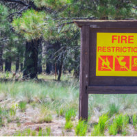
Firefighters across the Deschutes National Forest are continuing pile burning as favorable conditions exist. Firefighters select pile burning units for ignition based on moisture levels, forecasted weather and conditions predicted to move smoke away from communities where possible.
Planned ignition locations for this week include:
Bend-Fort Rock Ranger District
- National Forest System lands within Oregon Water Wonderland Subdivision in Sunriver
- Four miles northeast of La Pine along Forest Service Road 9750
- Three miles southeast of La Pine, south of Forest Service Road 2210
- Seven miles northeast of La Pine, north of Paulina Lake Road
- Five miles southwest of Sunriver, between Forest Service Roads 40 and 42
- Cascade Lakes Highway near Crane Prairie
Crescent Ranger District
- 20 miles west of Crescent in the area of Davis Lake
- Two miles west of Crescent, south of Crescent Lake Cutoff Road
- 10 miles west of Crescent, south of Highway 58 and Forest Service Road 6020
Sisters Ranger District
- Metolius Basin, directly west of Camp Sherman
- Two miles north of Black Butte near Forest Service Road 1130
- Half mile south of Suttle Lake near Dark Lake
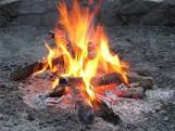
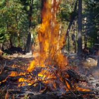
Piles may smolder, burn, and produce smoke for several days after ignition. Once ignited, firefighters monitor piles until they are declared out. Please do not report ignitions.
While smoke may linger in the area, removing these large accumulations of woody debris during the winter months minimizes fire danger. The piles are concentrations of leftover materials associated with vegetation management activities being done to help maintain and restore forest and ecosystem health while reducing hazardous fuels loading.
What does this mean for you?
The possibility exists for smoke to settle in low-lying areas due to cool night-time temperatures.
- When driving in smoky areas, drivers should slow down and turn on headlights
- If you have heart or lung disease, asthma, or other chronic conditions, ask your doctor about how to protect yourself from smoke
- Go to centraloregonfire.org to learn more about smoke safety and pile burning in Central Oregon
For more information on hazardous fuels reduction projects in Central Oregon, visit centraloregonfire.org/ or fs.usda.gov/deschutes and follow us on Twitter @CentralORFire. Text “COFIRE to 888-777 to receive wildfire and prescribed fire text alerts.
This work is occurring within the Central Oregon Landscape, one of 21 focal landscapes identified within the Forest Service’s Wildfire Crisis Strategy. The implementation of this work supports the Deschutes National Forest’s commitment to addressing the Wildfire Crisis Strategy which aims to reduce severity of wildfires, protect communities, and improve the health and resiliency of fire-dependent forests