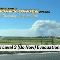
For the first time since the Flat Fire began, all Level 3 (Go Now) evacuation orders in Deschutes County have been dropped. Significant progress on fire lines today has allowed the Deschutes County Sheriff’s Office—working in coordination with incident commanders and fire operations—to reduce all Level 3 areas to Level 2 (Be Set).
In addition, several Level 2 (Be Set) areas have been reduced further to Level 1 (Be Ready). If you choose to return home, please remain Be Ready or Be Set to leave again should conditions change. Also, be aware of fire equipment and smoky conditions in the area.
Effective 5 p.m. today (August 28, 2025), all remaining Level 3 (Go Now) areas are reduced to Level 2 (Be Set):
- The 17700 Block of Mountain View Rd north to the end
- Henkle Butte area, including Stardust Ln, Canyon Crest Dr, and Vista Ridge Dr
- Wilt Rd from Big Buck Ln to the County Line
- Both sides of Edmundson Rd between Holmes Rd and Goodrich Rd
- Between Wilt Rd MP 4 West to Stevens Canyon North to the County Line
- Residences on the north end of Mountain View Rd, north of the 17700 Block
- Both sides of Wilt Rd from Big Buck Ln north to the Deschutes/Jefferson County line
- Areas North and West of Holmes Rd, North of milepost 5 to Lower Bridge Rd
- The upper (Southern) portion of McKenzie Canyon
- Panoramic Estates off Camp Polk Rd
Also effective 5 p.m. today, the following Level 2 (Be Set) areas are reduced to Level 1 (Be Ready):
- Old Military Rd
- Camp Polk Meadow and Cemetery area
- Junipine Acres on Fair Mile Rd, including Wren Ln and Suntree Ln
- Residences off Wilt Rd between Camp Polk and Stardust
- Lower (Northern) portion of McKenzie Canyon
- Stevens Canyon area
- Aspen Lakes Subdivision and golf course
- Hurtley Ranch Rd south of Emerald Valley Rd
- Area between Camp Polk Rd, west along Hwy 126 to include the Junipine Ln area, and north to Old Military Rd
- Area North and East of Lower Bridge Rd to the Deschutes River
- Areas north of Hwy 126, including Goodrich Rd, Holmes Rd, and Fadjur Ln
We will continue to evaluate conditions and adjust evacuations as necessary.
The current evacuation areas are as follows:
LEVEL 2 (Be Set)
- Whychus Canyon Estates from Wilt Rd north to the end of Mountain View Rd
- Henkle Butte area, including Stardust Ln, Canyon Crest Dr, and Vista Ridge Dr
- Wilt Rd from Stardust to the county line
- Wilt Rd from Big Buck Ln to the County Line
- Both sides of Edmundson Rd between Holmes Rd and Goodrich Rd
- Between Wilt Rd MP 4 West to Stevens Canyon North to the County Line
- Areas North and West of Holmes Rd and Edmundson to Lower Bridge Rd
- The upper (Southern) portion of McKenzie Canyon
- Panoramic Estates off Camp Polk Rd
Level 2 means Be Set to evacuate. Prepare to leave at a moment’s notice. This level indicates significant danger to your area. Residents should consider relocating or be ready to evacuate at a moment’s notice. Emergency services may not be able to notify you if conditions deteriorate.
LEVEL 1 (Be Ready)
- Dry Canyon area between Lower Bridge Rd south to Hwy 126
- Old Military Rd
- Camp Polk Meadow and Cemetery area
- Junipine Acres on Fair Mile Rd, including Wren Ln and Suntree Ln
- Residences off Wilt Rd between Camp Polk and Stardust
- Lower (Northern) portion of McKenzie Canyon
- Stevens Canyon area
- Aspen Lakes Subdivision and golf course
- Hurtley Ranch Rd south of Emerald Valley Rd
- Area between Camp Polk Rd, west along Hwy 126 to include the Junipine Ln area, and north to Old Military Rd
- Area North and East of Lower Bridge Rd to the Deschutes River
- Areas north of Hwy 126, including Goodrich Rd, Holmes Rd, and Fadjur Ln
Level 1 means Be Ready for potential evacuation. Be aware of danger in your area and monitor emergency services websites and local media. This is the time to prepare, especially for those with special needs, mobile property, pets, and livestock.
IMPORTANT RESOURCES
- Current maps, including evacuation areas: deschutes.org/emergency
- Fire information: centraloregonfire.org and the Flat Fire Facebook page
- Sign up for emergency alerts: deschutesalerts.org