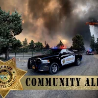
Due to significant growth of the Little Lava Fire to the east, the Deschutes County Sheriff’s Office in coordination with fire managers expanded the evacuation areas Monday night.
Current Level 3 (Go Now):
- Previous evacuation areas around Mt Bachelor south to to Forest Service Rd 40, west of FS Rd 41 (Conklin Rd), and south of FS Rd 4140.
- Areas south of FS Rd 40, north of FS Rd 42 (South Century Drive), east of FS Rd 4032, and west of the Deschutes National Forest Boundary.
Level 3: Means “GO” evacuate now. Leave immediately! Danger to your area is current or imminent, and you should evacuate immediately. If you choose to ignore this advisement, you must understand that emergency services may not be available to assist you further. DO NOT delay leaving to gather any belongings or make efforts to protect your home. This will be the last notice you receive.
Current Level 2 (Be Set):
- Areas south of FS 40, north of FS 42 (South Century Drive), west of FS Rd 4210, and east of FS Rd 4032.
- Areas east of FS Rd 45 (River Summit Dr) to FS 41 (Conklin Rd), south of Century Drive, and north of FS Rd 4140.
- Deschutes National Forest east of FS Rd 41 (Conklin Rd),west of the Deschutes River, north of FS Rd 40/Spring River Dr and south of Benham Falls. Excluding private property, which is Level 1 (Be Ready).
Level 2: Means “BE SET” to evacuate. You must prepare to leave at a moment’s notice. This level indicates there is significant danger to your area, and residents should either voluntary relocate to a shelter or with family and friends outside of the affected area, or if choosing to remain, to be ready to evacuate at a moment’s notice. Residents MAY have time to gather necessary items, but doing so is at their own risk. This may be the only notice you receive. Emergency services cannot guarantee that they will be able to notify you if conditions rapidly deteriorate. Area media services will be asked to broadcast periodic updates.
Current Level 1 (Be Ready):
- Areas west of the Deschutes River from Fall River Estates north to Spring River Rd, including Fall River Estates, River Forest Acres, River Meadows, Stage Stop Meadows, and Deschutes River Recreational Homesites.
- Areas north of Spring River Rd west of the Deschutes River including Besson Rd area and Spring River Acres.
- Sunriver
Level 1: Means “BE READY“ for potential evacuation. Residents should be aware of the danger that exists in their area, monitor emergency services websites and local media outlets for information. This is the time for preparation and precautionary movements of persons with special needs, mobile property and (under certain circumstances) pets and livestock. If conditions worsen, emergency services personnel may contact you via an emergency notification system.
Current maps including evacuation areas can be found at:
https://deschutes.org/
For fire information, you can visit the Central Oregon Fire Information site at: