The Darlene 3 Fire near La Pine is now fully contained. Firefighters continue mopping up and looking for hotspots within the first 100 feet of the fire perimeter. Standing, unstable burned trees and stump holes with hot ash are within the fire area, firefighters are remaining cautious and taking care of these hazards as they can safely do so. Personnel are working to rehabilitate fire suppression activities within the interior portion of the fire and are back hauling supplies that are no longer needed. Resources working the fire have been identified to help with initial attack should there be any new starts in the area.
Tuesday morning a local Type 4 incident commander will assume command of the Darlene 3 Fire. The COFMS Type 3 team will work closely with the incoming incident commander today to ensure there is a seamless transition of the fire. Engines, handcrews, water tenders, falling teams and heavy equipment will continue to work under the incoming Type 4 incident commander securing and rehabilitating the fire area. This will be the last daily update for the Darlene 3 Fire.
A warming trend begins today in Central Oregon, with temperatures by the end of the week expected to be near 100 degrees. With the Fourth of July holiday approaching visitors and community members need to remember it only takes one spark to cause the next accidental wildfire. Public use fire restrictions went into effect today across Central Oregon. Please be sure to recreate responsibly and check fire restrictions for private and public lands.
Central Oregon District enters high fire danger July 1 | ODF Central Oregon District News
For the most up-to-date official evacuation information please visit Deschutes County evacuation information: www.deschutes.org/emergency.
Air quality information can be found at aqi.oregon.gov or by downloading the OregonAir app.
The public is urged to respect the current FS and BLM closure areas for the safety of themselves and our firefighters. Closure areas are being evaluated daily, and as fire activity allows the areas will be changed as appropriate. The Prairie Campground and the Rosland OHV area and associated trails will remain closed temporarily. McKay Crossing Campground, Ogden Group Campground and 6 Mile Sno Park reopened at noon on Sunday, June 30.
An Area Emergency Closure is in effect on the Deschutes National Forest, the notice and closure map are available here: https://www.fs.usda.gov/Internet/FSE_DOCUMENTS/fseprd1183408.pdf. Paulina Lake Road and Forest Service Road 22 east of the closure boundary are still open for public use.
The Prineville District Bureau of Land Management’s Emergency Public Land Closure also remains in effect. This notice is available online at https://www.blm.gov/programs/public-safety-and-fire/fire-and-aviation/regional-info/oregon-washington/fire-restrictions.
For continued updates on this fire and future wildfires in Central Oregon, visit centraloregonfire.org or follow fire information on X (Twitter) @CentralORFire. The Central Oregon Fire Info phone line is also available for community and media at: 541.316.7711.
After consultation with fire managers, the Deschutes County Sheriff’s Office is lowering some evacuation levels effective 6 PM on July 1, 2024. These levels may change again as conditions change. Residents should remain vigilant and stay informed about changing conditions.
Current evacuation notices:
Level 2: Be Set – All areas immediately surrounding the Darlene 3 Fire including areas east of the BNSF railroad tracks, north of the Deschutes/Klamath County line, and public lands managed by the Bureau of Land Management and United States Forest Service.
Level 1: Be Ready – Newberry Estates subdivision off of Rosland Road and the commercial areas east of Hwy 97 near Wickiup Junction including areas off of Drafter Rd and Rosland Rd. Additionally all areas bound east of Hwy 97, north of Hwy 31 and west of the BNSF rail road tracks.
All other areas under various evacuation notices have remained unchanged.
Updated maps and information can be found at www.deschutes.org/emergency.
Numerous road closures remain in effect around the fire. The public is asked to respect these road closures as well as closures put in place by the Deschutes National Forest and Prineville District of the Bureau of Land Management. These closures are in place to protect the public and firefighters working in the area.
UPDATE June 28, 2024 12:00 PM *****
After consultation with fire managers, the Deschutes County Sheriff’s Office is lowering some evacuation levels. These levels may change again as conditions change. Residents should remain vigilant and stay informed about changing conditions.
The Newberry Estates subdivision has been reduced from Level 3: Go Now to Level 2: Be Set. Residents should understand there is still risk and they should be prepared to evacuate at a moment’s notice.
The residential area immediately north of Burgess Rd and east of the Little Deschutes River has been reduced from Level 1: Be Ready to no evacuation notice.
All other areas under various evacuation notices have remained unchanged.
Updated maps and information can be found at www.deschutes.org/emergency.
Numerous road closures remain in effect around the fire. The public is asked to respect these road closures as well as closures put in place by the Deschutes National Forest and Prineville District of the Bureau of Land Management. These closures are in place to protect the public and firefighters working in the area.
UPDATE June 27, 2024 11:30 AM *****
After consultation with fire managers, the Deschutes County Sheriff’s Office is adjusting evacuation levels. These levels may change again as conditions change.
Level 3: Go Now evacuation levels include:
All areas east of the the BNSF railroad tracks to FS Road 9736 and FS 22 (Finley Butte Rd) and north of the Deschutes/Klamath Line north to just north of Newberry Estates subdivision.
Level 2: Be Set evacuation levels include:
Areas immediately east of Hwy 97 north of the line even with the Hwy 97/Burgess Rd north to include Drafter Rd area. (reduced from Level 3)
Industrial area on Russel Rd from Reed Rd south to the end of Russel Rd (reduced from level 3).
Areas north of Hwy 31 between Hwy 97 east to the BNSF Railroad tracks.
Areas north of FS Rd 21 (Paulina-East Lake Rd) to Paulina Creek west of FS 9736.
Level 1: Be Ready evacuation levels include:
Residential area immediately west of Hwy 97, north of Burgess Rd and east of the Little Deschutes River.
Updated maps and information can be found at www.deschutes.org/emergency.
UPDATE June 26, 2024 11:33 AM *****
Level 1 BE READY evacuation level has been issued for the area west of Hwy 97 north of Burgess Rd. east of the Little Deschutes River and south of Riverview Dr.
UPDATE 6:57 PM *****
Evacuation level reduced to Level 2 BE SET. The area east of Hwy 97 south of Bassett Dr between the train tracks has been reduced from Level 3 to Level 2.
UPDATE 6:09 PM*****
Level 3 GO NOW Evacuations for the areas east of Hwy 97 south of Drafter Rd. South of Bassett Dr. to Hwy 31.
Level 2 BE SET Evacuations for the area east of Hwy 97 to the train tracks from Reed Rd. south to Bassett Dr.
Please continue to deschutes.org/emergency for the most up to date evacuation levels
UPDATE 5:38 PM*****
A livestock and small animal shelter has been established at the La Pine Rodeo Grounds with support from the Pet Evacuation Team.
UPDATE 3:48 PM ********
Level 3 GO NOW Evacuations have been issued for the area east of Hwy 97 north of Reed Rd including areas off Rosland Rd. and Newberry Estates.
The Deschutes County Sheriff’s Office is assisting with a fire in the area of Darlene Way and Finley Butte Rd. in La Pine.
Level 3 GO NOW Evacuations have been issued for the area east of the railroad tracks near Darlene Way and Ice Cave Rd.
Level 2 BE SET Evacuations have been issued for the areas east of Hwy 97 and south of Rosland Pit.
Level 1 BE READY Evacuations have been issued for the area east of Hwy 97 along Rosland Rd including Newberry Estates.
A temporary evacuation point has been established at La Pine High School for evacuees needing support.
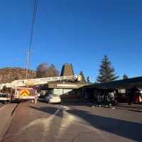
Please avoid the area as there is a large amount of fire equipment working on this fire.
For the most updated information please go to deschutes.org/emergency